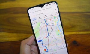
Internet search engine giant Google has now added maps depicting areas of North Korea to its Google Maps product. The territory was chalked out with the help of citizen cartographers, as much of the country was left blank until now on Google’s application.

North Korea is slowly being mapped out by the tech giant after its CEO Eric Schmidt visited the country recently, in a move that made headlines worldwide. The Google Map Maker tool was used by citizen cartographers to draw out various places of interest in North Korea, including temples, prison camps and road names. Schmidt said that opening the internet for the country was the way for them to move forward, rather than closing their doors to the world.
The city of Pyongyang was the most visibly altered in Google Maps. Initially there was not much information available for the town, however of late there has been a lot of detailing that is visible, including subway stations, parks and highways.
The senior product manager of the Google Map Maker tool, Jayanth Mysore, said that it has taken a few years for the community of citizen cartographers to help draw out the points of interest in North Korea. He went on to say that the maps are more informative than before and finally the world would be able to have access to view the country on Google’s application.